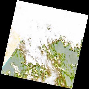
LC09_L2SP_161056_20220131_20220202_02_T2_SR_stac
dataset of product ls9_sr
Indexed by odc_writer
,
created
Region
161056
for
31st January 2022
Fields 🔗
cloud_cover
83.17
collection_category
T2
creation_time
2022-01-31 06:58:12
crs_raw
•
data_coverage
•
dataset_version
•
eo_gsd
•
eo_sun_azimuth
129.137
eo_sun_elevation
52.887
format
GeoTIFF
id
d700e2b6-425e-51f3-8e40-952e92239557
instrument
OLI_TIRS
label
•
lat
4.737 to 6.824
lon
48.421 to 50.439
platform
LANDSAT_9
product_family
•
region
•
region_code
161056
rmse
nan
rmse_x
nan
rmse_y
nan
sat_orbit_state
•
sat_relative_orbit
•
time
2022-01-31 06:58:12 to 2022-01-31 06:58:12
Related Datasets 🔗
LC09_L2SP_161056_20220131_20220202_02_T2_SR_stac