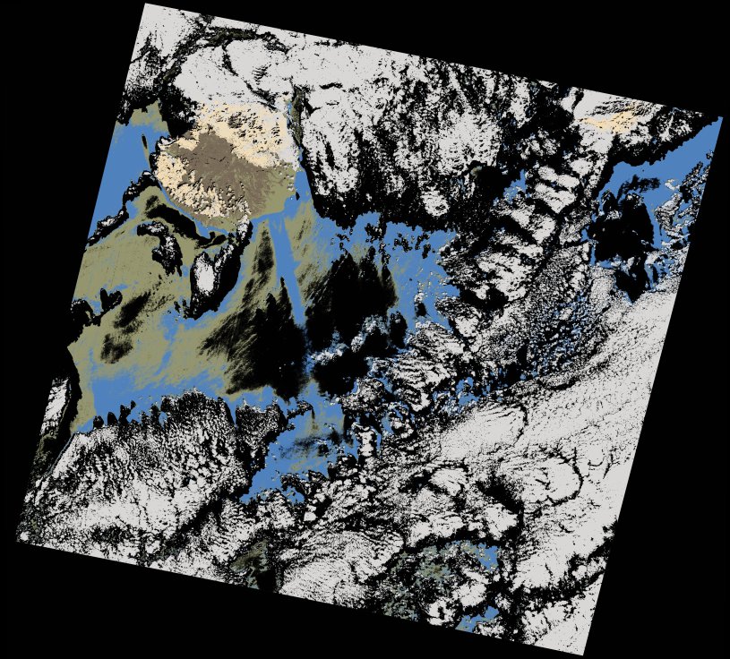
wofs_ls_206041_2022-10-09.stac-item
dataset of product wofs_ls
Indexed by odc_writer
,
created
Region
206041
for
9th October 2022
Fields 🔗
cloud_cover
47.66
collection_category
T1
creation_time
2023-03-26 14:00:52
crs_raw
•
data_coverage
•
dataset_version
1.0.0
eo_gsd
30.0
eo_sun_azimuth
148.134
eo_sun_elevation
51.37
format
GeoTIFF
id
95fd2e45-4c4b-557a-b094-640f93ff9cf2
instrument
OLI_TIRS
label
•
lat
26.377 to 28.473
lon
-16.29 to -14.012
platform
landsat-9
product_family
wofs
region
•
region_code
206041
rmse
6.232
rmse_x
4.279
rmse_y
4.531
sat_orbit_state
•
sat_relative_orbit
•
time
2022-10-09 11:30:26 to 2022-10-09 11:30:26
Related Datasets 🔗
wofs_ls_206041_2022-10-09.stac-item