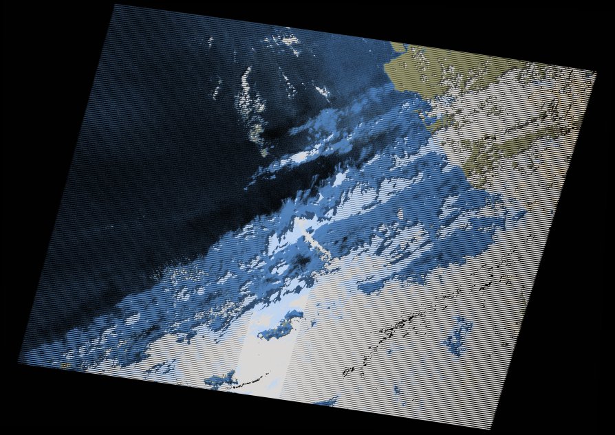
wofs_ls_202035_2021-02-12.stac-item
dataset of product wofs_ls
Indexed by odc_writer
,
created
Region
202035
for
12th February 2021
Fields 🔗
cloud_cover
32.0
collection_category
T1
creation_time
2021-09-01 04:43:58
crs_raw
•
data_coverage
•
dataset_version
1.0.0
eo_gsd
30.0
eo_sun_azimuth
139.013
eo_sun_elevation
30.003
format
GeoTIFF
id
0de749df-4c51-5551-8d14-929a8996d7d0
instrument
ETM
label
•
lat
35.11 to 37.01
lon
-8.076 to -5.482
platform
landsat-7
product_family
wofs
region
•
region_code
202035
rmse
5.547
rmse_x
3.368
rmse_y
4.407
sat_orbit_state
•
sat_relative_orbit
•
time
2021-02-12 10:18:23 to 2021-02-12 10:18:23
Related Datasets 🔗
wofs_ls_202035_2021-02-12.stac-item